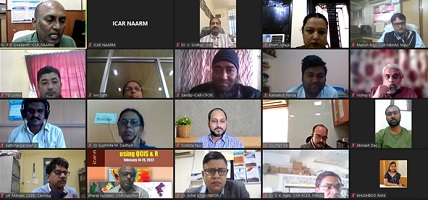
19th February, 2022, Hyderabad
The 6-day Virtual Training Programme on “Geo-spatial Analysis using QGIS & R” organized by the ICAR-National Academy of Agricultural Research Management, Hyderabad from 14th to 19th February, 2022 concluded today.

Delivering the valedictory address, Dr. Bharat S. Sontakki, Head (Extension Systems Management), ICAR-NAARM, Hyderabad highlighted the importance of Geospatial Analysis in Agriculture. He stated that the GIS and Remote Sensing in Agriculture helps the farmers to achieve the increased production and reduced costs by enabling better management of the land resources.
The programme was aimed at orienting the researchers with the understanding and application of the Geospatial Technologies and developing a decision support framework for managing the agricultural production system for sustainability using the open source data and softwares.
A total of 45 participants from the various ICAR Institutes, State Agricultural Universities and Krishi Vigyan Kendras participated in the programme.
(Source: ICAR-National Academy of Agricultural Research Management, Hyderabad)


Like on Facebook
Subscribe on Youtube
Follow on X X
Like on instagram